Lake Superior is the largest freshwater lake in the world. Its rocky shoreline is over 2500 miles long, and wanders through Ontario, Minnesota, Wisconsin and Michigan. In addition to wild forests, beautiful rocky beaches, and towering cliffs, there are a great number of waterfalls on or near the shores of Superior. Below are descriptions of some of the many waterfalls you can visit while circling Lake Superior.
Starting at Sault Ste. Marie, first visit Crystal Falls in the Hiawatha Highlands Park. 20km north of Sault Ste Marie, and 20km to the east on Highway 556 you can find Beaver Falls. Driving north 55km on Highway 17 from Sault Ste Marie will take you to the roadside Chippewa Falls. 15 km beyond that, you will pass Batchawana Falls, which is 7 km east of Highway 17 on a bumpy logging road. Just beyond this the small Pancake Falls can be found near Pancake Bay Provincial Park.
You will then drive through Lake Superior Provincial Park, home to many waterfalls. The Sand River Falls are right alongside Highway 17. Gargantua River Falls and Baldhead River Falls can be reached with a couple hours of hiking. Agawa Falls is your reward for a day long hike along the Towab trail, and many miles upstream of that, Bridal Veil Falls and the other falls of Agawa Canyon can be found. Lady Evelyn Falls and Calwin Falls are deep in the inland of Lake Superior Provincial Park. Till Creek Falls and Bushy Falls are remote falls along the coast. Montreal Falls is just south of the park.
North of Lake Superior Provincial Park is Michipicoten and Wawa, where you will find Silver Falls and the High Falls of the Magpie River. The small and out of the way Potholes Provincial Park is 70km east of Wawa.
You now can take a breather, or go looking for some real adventure. North of Wawa Highway 17 heads inland away from the lake. The lake will not be visible again until you reach Marathon 180 kilometers beyond Wawa. Along the way you can take a 58 kilometer one way side trip up Highway 614 to Manitouwadge followed by as many kilometers on logging roads to reach the High Falls of the Pic River, the Middle Falls, Twin Falls and Manitou Falls. This excursion would require a whole day and a rugged vehicle.
Beyond Highway 614, just east of Marathon, is the entrance to Pukaskwa National Park. Long hikes or canoe trips will take you to Cascade Falls on the shores of Lake Superior, or Umbata Falls on the White River. It would take several days to see all of these remote waterfalls.
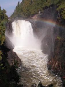
The less adventurous can look for Mink Creek Falls near Marathon, or continue on to Terrace Bay, where the 100 foot Aguasabon Falls can be found. 18 km past Terrace Bay is Rainbow Falls.
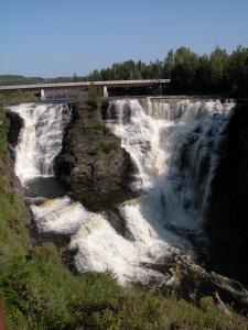
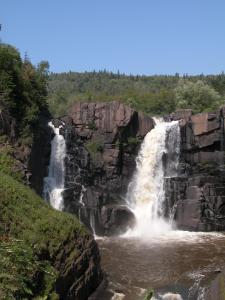
Continuing west, there is a bit of a lull in the waterfall action for the next 100 km until you reach Dorion (although there may be all sorts of obscure waterfalls of which I am not aware). In Dorion you can spend several hours on an adventurous drive and hike out to Upper Wolf River Falls. 80 km further down Highway 17 is Thunder Bay, and 25 km west of that is the very impressive and not to be missed Kakabeka Falls. 60 km south of Thunder Bay is Middle Falls of the Pigeon River and the High Falls of the Pigeon River, the last of the Canadian Lake Superior WaterFalls.
When you cross into Minnesota, Grand Portage State Park will be on your right. From here you can take a short walk out to the High Falls of the Pigeon River. This is the highest waterfall in Minnesota. Continuing southwest on Highway 61, you next pass Judge C.R. Magney State Park, where you will find the mysterious Devil's Kettle Falls and the Upper Falls of the Brule River. Small falls can be found in Cascade River State Park and Temperance River State Park.
Further along Highway 61 you will see the roadside Cross River Falls and a short hike takes you to Caribou Falls. If you journey inland to the wild Park you can find Manitou Cascades.
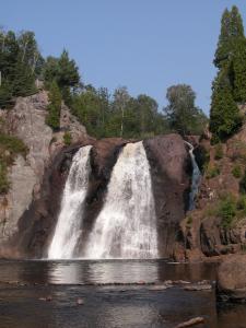
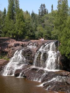
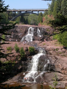
At Tettegouche State Park you will find The High Falls of the Baptism River, Two Step Falls, and Illgen Falls. Next you can see the Upper, Middle and Lower Gooseberry Falls, and Fifth Falls at Gooseberry State Park.
You will encounter more and more civilization as you make your way through Duluth and into Wisconsin. Highway 35 south will take you to Pattison State Park where you will find Big Manitou Falls and Little Manitou Falls. Working your way east on county roads to Highway 2 will take you to Amnicon Falls in Amnicon Falls State Park. Route 13 will take you along the shores of Lake Superior and past Siskiwit Falls.
Lost Creek Falls and Siskiwit Falls are located further east near near the shores of Lake Superior. In the Mellen area a number of waterfalls can be found. The remote Morgan Falls is in the Chequamegon-Nicolet National Forest. Copper Falls and Brownstone Falls are in Copper Falls State Park. The very impressive Potato River Falls are in Gurney. The wild Foster Falls and Wren Falls are also nearby.
The Montreal River forms part of the border between Wisconsin and Michigan. The river features an impressive canyon with 200' walls and a number of waterfalls including Superior Falls, Saxon Falls, and Peterson Falls.

In Michigan you can visit the Falls of the Black River. Here along the Black River Scenic Byway you can easily visit five waterfalls: Rainbow Falls, Sandstone Falls, Gorge Falls, Potawatomi Falls and Great Conglomerate Falls. Farther upstream on the Black River you can find the equally impressive Gabbro Falls.
Farther east and north of Highway 2 you will find Porcupine Mountains State Park where you can see Manabezho Falls and the other waterfalls of the Presque Isle River. A day or two of hiking will take you to numerous other falls such as Shining Cloud Falls and Trappers Falls.
A side trip away from the shores of Superior will take you to Bond Falls, Agate Falls, and O Kun de Kun Falls, all near Bruce Crossing. These are three of the most impressive waterfalls in Michigan and well worth the trip. The first two are easily visited. The third is a wild waterfall reached by a 1.3 mile hike.
You can journey up to the Keewenaw Peninsula and see roadside falls such as Jacob Falls, Eagle River Falls, and Haven Falls, or the remote Montreal Falls.
Leaving the Keweenaw you can stop by Hungarian Falls north of Houghton Hancock. There are three significant falls on Hungarian Creek, and a couple smaller ones. These are best seen during wet weather. Some other seasonal falls can be found in the area. Farther south you can find Sturgeon Falls and Canyon Falls, both on the Sturgeon River.
Between L'Anse and Marquette is a wild region largely devoid of paved roads. Here you can find Slate River Falls, Big Falls and others. The rough dirt roads will take you all the way to Big Bay where Pinnacle Falls, Alder Falls and others can be found. The more direct route from L'Anse to Marquette is Highway 41. Before reaching Marquette you might also want to visit Black River Falls which is about 8 miles southwest of Ishpeming. This waterfall is actually in Lake Michigan's watershed, but it is much closer to Lake Superior and not far from the Lake Superior Circle Tour route. Just south west of Marquette you can find the Carp River Falls and Morgan Falls, or you can head north on paved roads to reach Alder Falls.
From Marquette you can head towards Munising. The direct route to Munising from Marquetee is to take Highway 28. However if you want to see waterfalls take 41 down to 94 and then 94 towards Munising. Along the way you will pass Laughing Whitefish Falls, Rock River Falls and Autrain Falls. There are a large number of falls of various sizes in and around the Munising area such as Alger Falls, Munising Falls and Wagner Falls.
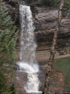
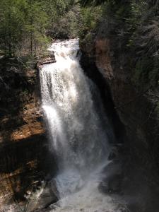
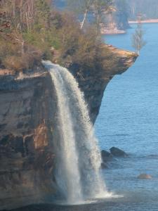
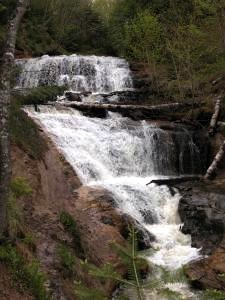
From Munising you can also explore Pictured Rocks National Lake Shore. Hikes will take you Miners Falls, Chapel Falls and Mosquito Falls. Bridal Veil Falls and Spray Falls fall directly into Lake Superior and are best seen by boat. At the eastern end of Pictured Rocks you can see Sable Falls.
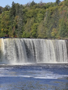
Finally you can head east along Highway 28 and then north on Highway 123 to impressive Tahquamenon Falls. Another two hours beyond that takes you back to Sault Ste. Marie, where you can begin another loop around the lake, or take a tour around Lake Huron.
All of the above falls, with the exception of Crystal Falls, eventually empty into Lake Superior. There are many other falls whose waters eventually make their way to the largest fresh water lake in the world. And where do those waters go? Lake Superior empties into Lake Huron, which empties into Lake Erie, which empties into Lake Ontario by means of the Niagara river and Niagara Falls.
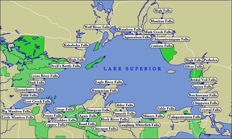
This map shows the locations of some of the waterfalls around Lake Superior that I have visited. You can also look at the Scrollable Map of Lake Superior Waterfalls.