


This waterfall is hidden away in the Chequamegon-Nicolet National Forest, and is relatively easy to get to despite being fairly remote. It is only a 1.2 round trip hike to the falls, but you have to first travel on several miles of forest roads.
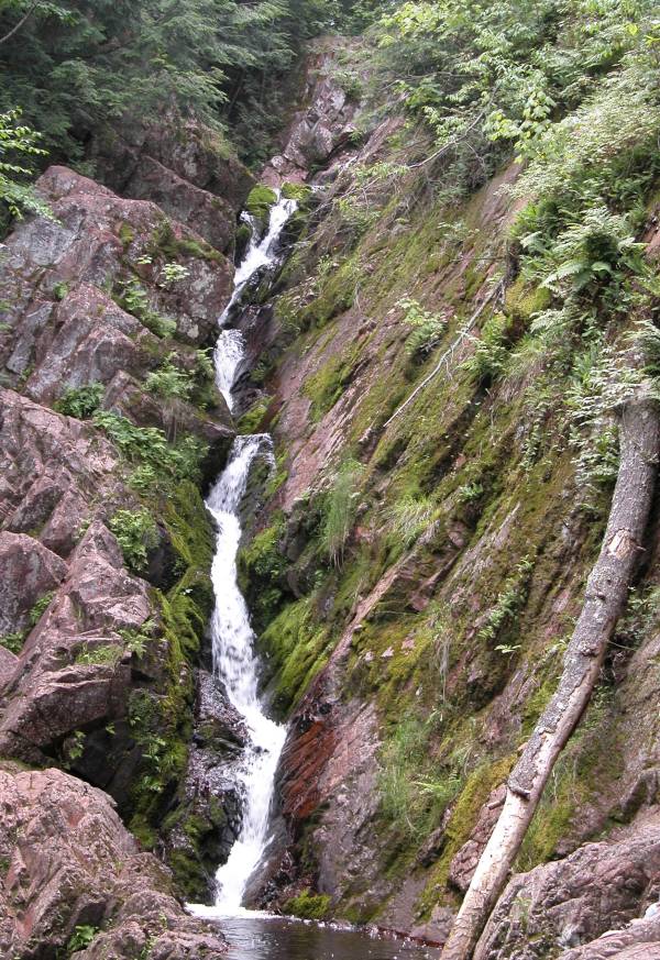
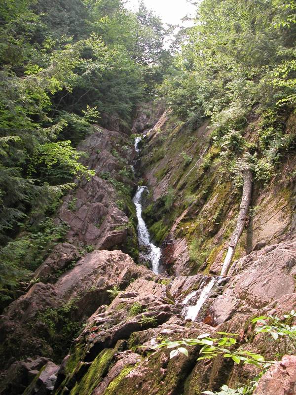
The waterfall is a steep, narrow cascade that sort of zig zags along the crevices in the rock. The topmost part of the waterfall is not visible in the pictures and I am not sure how high it is. The main drop is about 40 feet high. This lands in a small splash pool. The creek then does nearly a 180 before falling the final 8 feet. The National Forest Service lists the height of the falls as 70 feet, but I have seen the total height of the falls listed as 100 feet.
Morgan Falls is in a remote location. From Copper Falls State Park you can reach the falls by heading southwest on highway 169 to highway 13. Take a left (south) and drive for approximately 1/5 mile. Take a right on County Rd GG. Follow this road for 8 miles. The road takes a couple of sharp turns, but it is well marked. Turn right (north) on Forest road 187. The sign mentions Morgan Falls, as well as Beaver Lake and Lake Three. This is a gravel road but it is in good condition. Follow this road for 3 miles until you reach "Pine Stump Corner". There is an intersection here. You want to stay on FR 187 which goes to the right. After 1.4 miles you want to take a left onto Forest Road 199, which used to be known as County Line Road, but is currently known as Ashland-Bayfield Rd. Follow this for 5 miles. There will be a parking area on the right.
If you are coming from the north, or you do not want to spend so much time on forest roads, FR 199 intersects with County Rd C/E 4 miles due north. This is just west of where County Rd C and E meet, and about a mile south of where 112 and County Rd E meet. If you are traveling south on Hwy 13, take a right onto Hwy 112, and then a left (south) onto County Rd E when 112 ends. Shortly after this E starts heading west. FR 199 is about a mile past this on the left. From Mellen you could also head north on 13 and take a left on 112 if you want to minimize your time on dirt roads.
The trailhead for Morgan Falls is also the trailhead for St Peter's Dome, a large granite outcrop from which you can see Lake Superior on a clear day.
[Lake Superior] [Ashland & Iron County] Nearby Falls
Brownstone Falls and Copper Falls are in nearby Copper Falls State Park.
Photo Gallery
 |
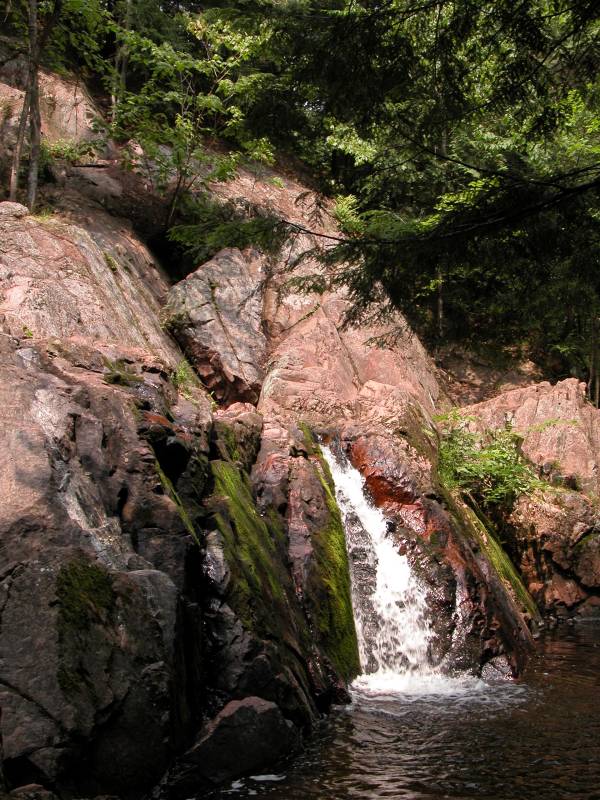 The final drop |
This page has been accessed
125628 times.
Last Modified:
Saturday, 03-Oct-2009 21:23:36 MDT.