


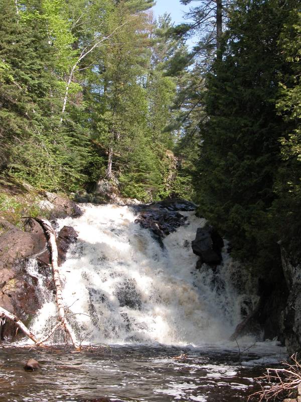
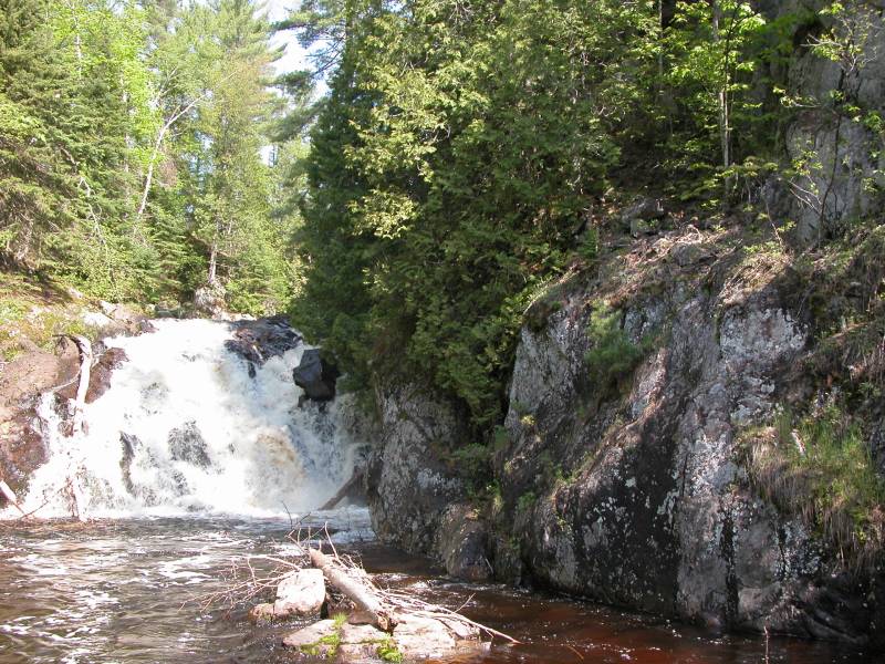
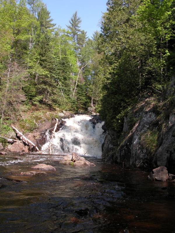
Pinnacle Falls is located on a wild stretch of the Yellow Dog River, roughly 8 miles south west of Big Bay. The Yellow Dog has carved out an impressive gorge that must be around 200 feet deep. The falls is about 25 feet high, and is a steep cascade like many of the falls in the area. The falls is named for the large pinnacle of rock on the right side of the falls.
Things have changed quite a bit since I visited this falls, and it is much easier to reach. From CR-550 south of Big Bay, head west on CR-510. CR-510 is now a paved road. It was widened and paved to provide better access to the new Eagle Mine. After about 3 miles you will reach the intersection of CR-510 and AAA. CR-510 turns to the south. Continue straight on AAA, which is paved. After roughly 6 miles, look for a dirt road to the south with a sign for Pinnacle Falls. The waypoint is roughly 46.7369N 87.8183W.
This road is more of a two track, but a normal car should be able to manage it. From this point on things get a bit trickier, as there are no road signs, and lots of little roads that do not appear on the maps. In retrospect I was rather lucky finding the falls as easily as I did. I am not sure how much has changed, but based on aerial maps, follow this road for 1 mile, at which point it will turn to the east. Continue another .7 miles, passing two roads on your right, and taking a right on to the third road. Continue down this road about .7 miles, keeping to the left. You should reach a parking area. The waypoint for the parking area is 46.71125N 87.80586W. The total trip from AAA is a bit over two miles.
Assuming the above directions worked, you should see a well worn trail heading into the trees. This trail quickly starts to descend steeply into the gorge. If you are in the right place you will soon encounter a small clearing with a wooden pillar that identifies this as Pinnacle Falls. Of course you are not at the falls yet, and must continue deeper into the gorge, and then around the 100+ foot high pinnacle itself, before you will see the falls.
I biked to the falls from AAA, but it looked like a regular car could have handled the roads.
This area has been recently preserved by the Yellow Dog Watershed Preserve.
[Lake Superior] [Marquette & Baraga County] Nearby Falls
The much easier to reach Yellow Dog Falls are several miles downstream. Marquette County has dozens of waterfalls, many of them are in remote locations in the wild area north and west of the city of Marquette. Most of them are better described as rapids as they tend not to be very high or steep. This site has a rather comprehensive list of the falls.
Photo Gallery
 |
 |
This page has been accessed
81195 times.
Last Modified:
Saturday, 08-Aug-2015 20:13:30 MDT.