


Mink Creek Falls is west of Marathon Ontario. Despite being featured on the town's brochures and travel guides, there are no signs or directions on how to get to the falls. They are fairly easy to find, but can be easily missed if you are not careful. The folks in town can give you directions.
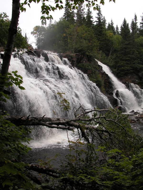
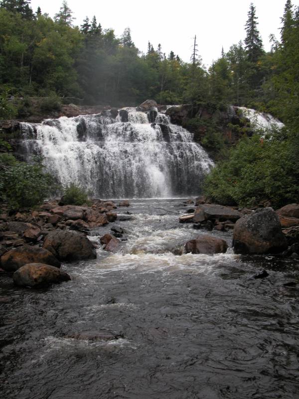
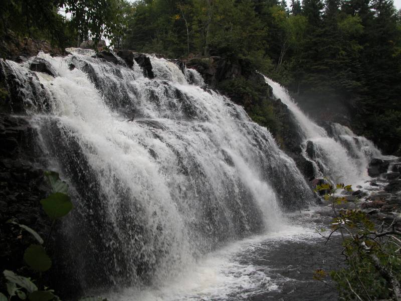
This waterfall is fairly typical of Lake Superior Waterfalls. It actually reminds me of Wisconsin's Potato Falls and Michigan's Bond Falls. The main falls is divided into two segments by a tree topped rocky outcropping. There are small drops above and below the main falls.
Mink Creek Falls is about 17.4 miles west of Marathon on Highway 17. It is just before the road to Coldwell. There is a dirt parking area on the north side of the road. There are no signs for the falls. This is part of a snowmobile trail. The falls are on the south side of the road. There is an obvious trail on the other side that leads to the falls. It is a short 5 minute walk. You can reach the top and base of the falls. The trails continue downstream but I do not know if they lead anywhere interesting.
This is a short movie of Mink Creek Falls.
[Lake Superior] Nearby Falls
Aguasabon Falls is 45 km to the west and Rainbow Falls is 30 km beyond that. Pukaskwa National Park is 30km to the east where you can find the remote Chigamiwinigum Falls and Umbata Falls.
Photo Gallery
|
|
This page has been accessed
60714 times.
Last Modified:
Sunday, 12-May-2019 12:52:52 MDT.