


Montreal Falls is located in the settlement of Montreal Harbour, where the Montreal River empties into Lake Superior. Despite the fact that most of the the river has been diverted for power generation this is a fascinating area. It is just south of Lake Superior Provincial Park, and the general scenery is beautiful. The gorge offers a lesson in geology, and a little imagination makes you realize that before the dam this must have been a truly impressive waterfall.
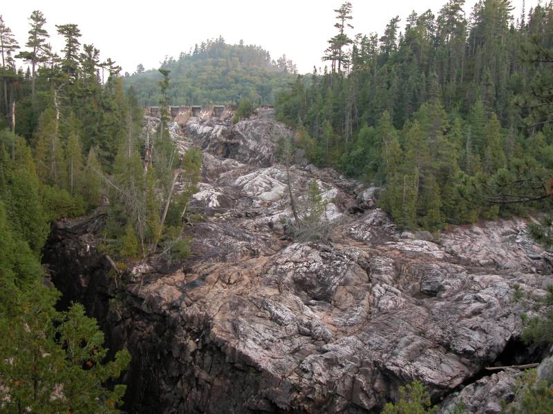
The Montreal River is one of the major rivers in this part of Ontario. There are at least two other dams upstream of the one at Montreal Harbor, and it looks like there were significant falls at both of these sites. The Algoma Central Railroad crosses over the upper of the two dams. I believe this upper dam was the site of the Montreal Falls for which the area was named. At Montreal Harbor, the river has chewed its way through a diabase dyke, resulting in a deep, narrow and very steep gorge. Highway 17 crosses this gorge, and you can briefly see the base of the falls as you drive over the bridge.
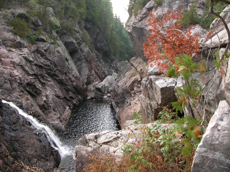
A large dam is located at the top of the falls. All of the water is diverted except for a small stream about two meters wide that slides 20 meters or so down a crevice into the carved out gorge. From the looks of it before the dam was put in the falls could have been around 50 meters wide. The falls would have been similar in appearance to Magpie High Falls or Aubrey Falls, where most of the river falls into the gorge perpendicular to the river's original flow. I have seen a photo of the falls full of water, but I have no idea if this is a regular, or predictable occurrence.
The falls are not all that visitor friendly. Just north of the bridge you can pull into the short access road that leads to part of the power station. Fishermen use this to get access to the gorge. A well worn, but unmaintained and steep trail begins beyond the far corner of the fenced off power generation equipment. This leads to a not very satisfactory viewpoint high above the falls. A less well worn trail continues up and away from the falls. This works its way along the northern edge of the gorge and some exploring will lead you to some much better vantage points. There are blazes marking the trail, but the trail is very rough with considerable deadfall in places and some very steep drop offs. I have no idea what the original purpose of the trail was.
Montreal Harbour consists of a few homes and lodges. There is a gas station and grocery store a short distance south of the falls. This is one of your last chances to get supplies until you get up towards Wawa.
The Montreal Falls Natural Heritage area was recently added to Lake Superior Provincial Park. However the natural area is located north of the Montreal river and does not include the area around this waterfall.
[Lake Superior] [Lake Superior Provincial Park] Nearby Falls
Agawa Fall, Sand River Falls, Gargantua Falls and Baldhead River Falls are all to the north in Lake Superior Provincial Park. Batchawana Falls and the roadside Chippewa Falls are to the south.
Photo Gallery
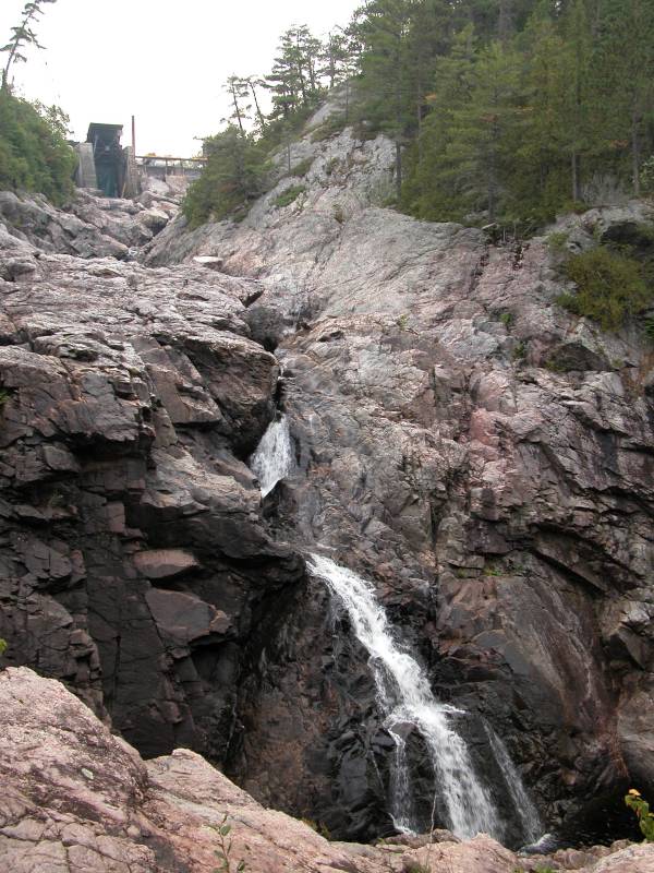 View with Dam at Top |
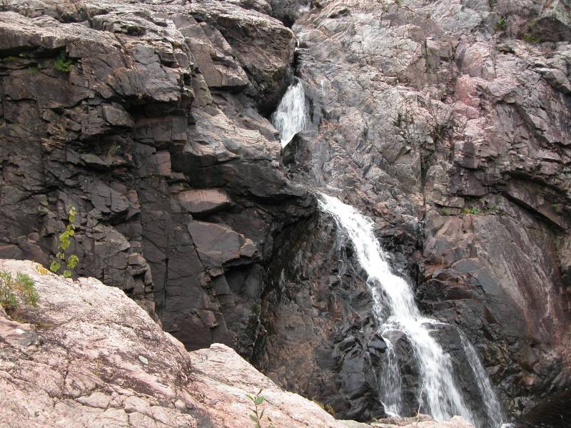 |
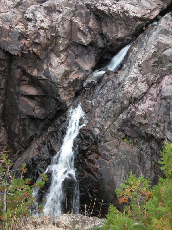 View from "overlook" |
 View from "overlook" |
 Dry Falls? |
 Remaining Diabase |
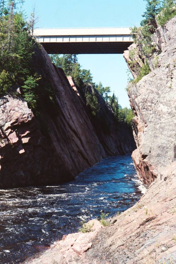 Hwy 17 crossing Gorge |
 |
This page has been accessed
64953 times.
Last Modified:
Saturday, 05-Jan-2019 14:13:07 MST.