


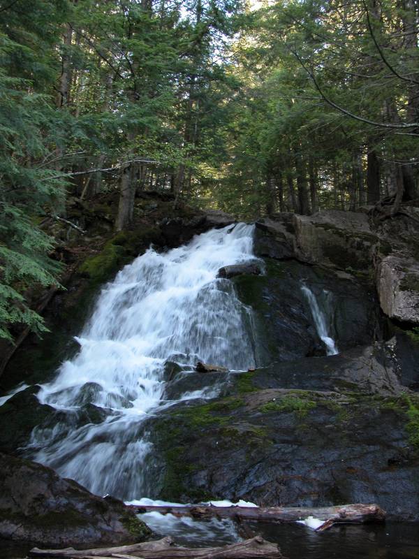
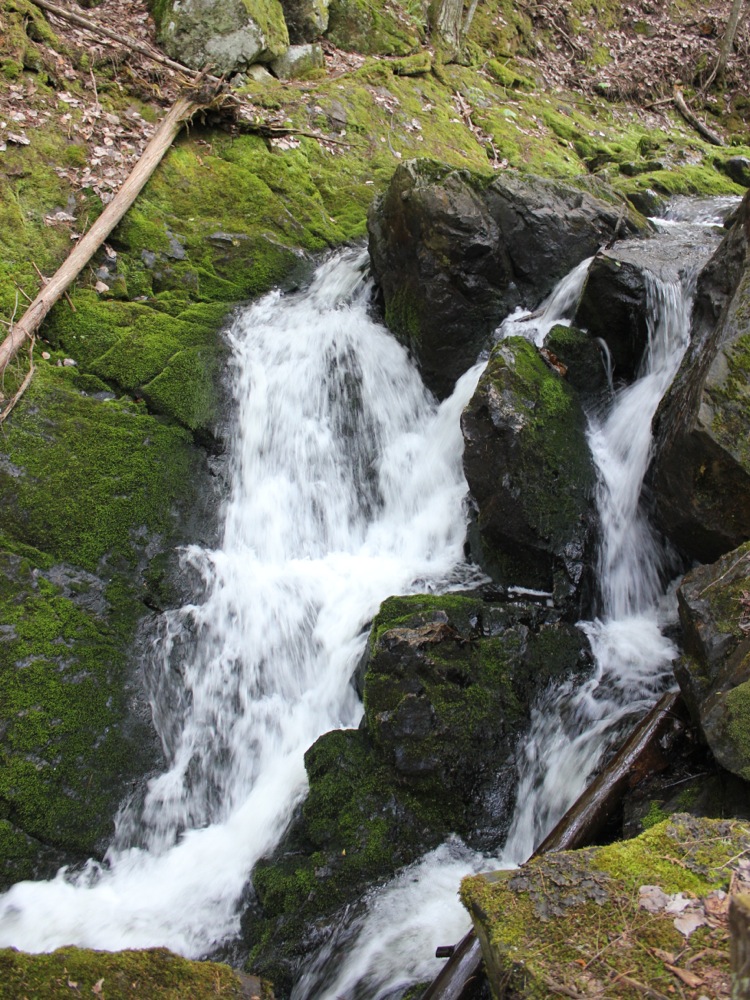
Alder Falls is located about 20 miles north of Marquette on County Road 550. This is Canadian Shield country and the falls is typical of the falls found there. The falls is a slide about 30 feet high cascading down at a 45 degree angle. It falls into a deep, secluded and well shaded gorge. The gorge adds to the sense of wildness and isolation of the falls, even though it is only a mile from the main road.
Finding this waterfall is not trivial because Marquette does not seem big on marking their waterfalls or their rivers and creeks. To reach the falls head north on Country Road 550 from Marquette. This is the road to Big Bay, which is about 25 northwest of Marquette. Alder Falls is about 20 miles northwest of Marquette. There are no signs for the falls or for the creek. MapQuest shows a town of Alder but there are no signs for that either. There are commercial signs with the word "Alder" in them near the falls. If I remember rightly, and if the information on Google I found is correct, "Alder Bay Lodging" is located right in the vicinity of the falls.
The road/trail to the falls is about 100 yards south-east of the creek, so if you are coming from Marquette you will pass this road before you cross the creek. Neither have signs so you can easily pass them both. :) According Mapquest the name of the road to the falls is "Alder Creek Truck Trail", which gives you a good idea what to expect. A driveway to several private homes is also located where the truck trail starts. This does have a sign, which says "N3071 to N3077"
To reach the falls follow the truck trail for about .6 miles. The truck trail is rough and sandy and there are a couple of spots that would be very tough for a regular car. If you do not think your car is up to it, it is only a 20-30 minute walk to the falls from County Road 550. After about .6 miles, look for a foot trail to the right with a sign above it that reads "No Motorized Vehicles or Litter Please". This trail leads down to the falls. It is rather steep in places, so be careful.
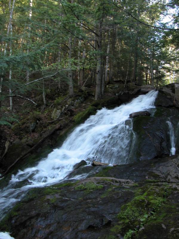
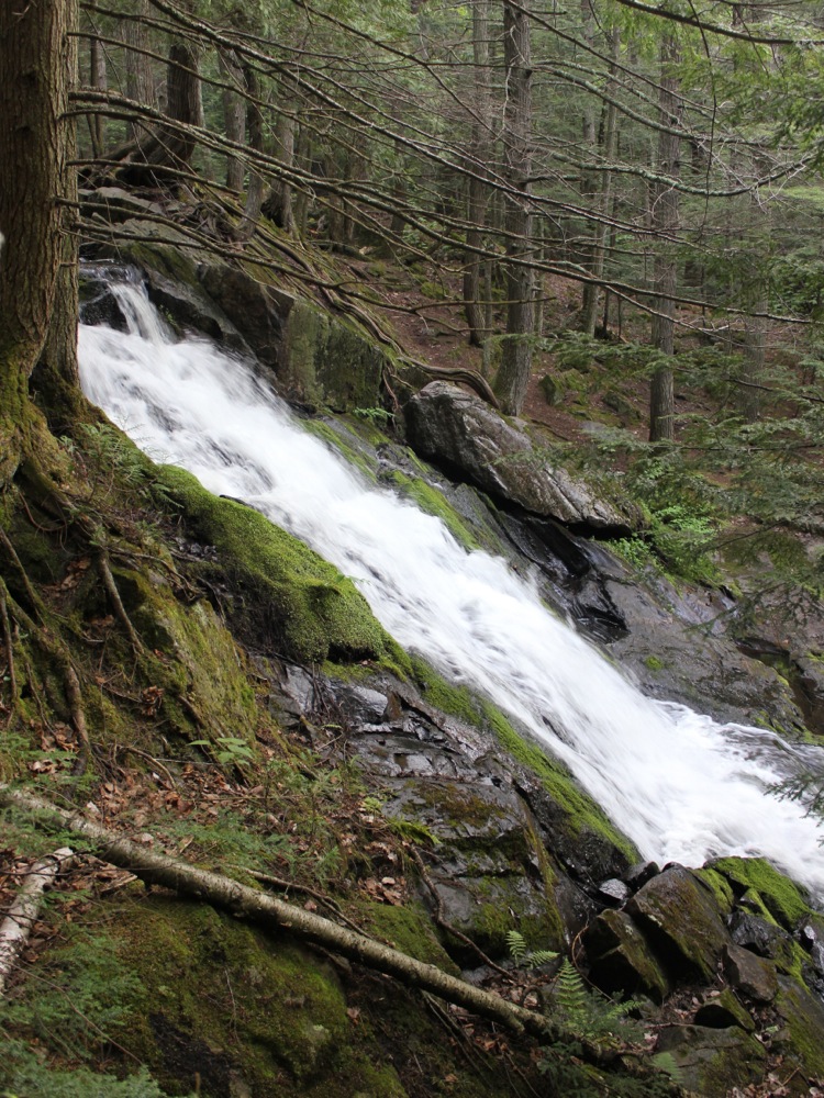
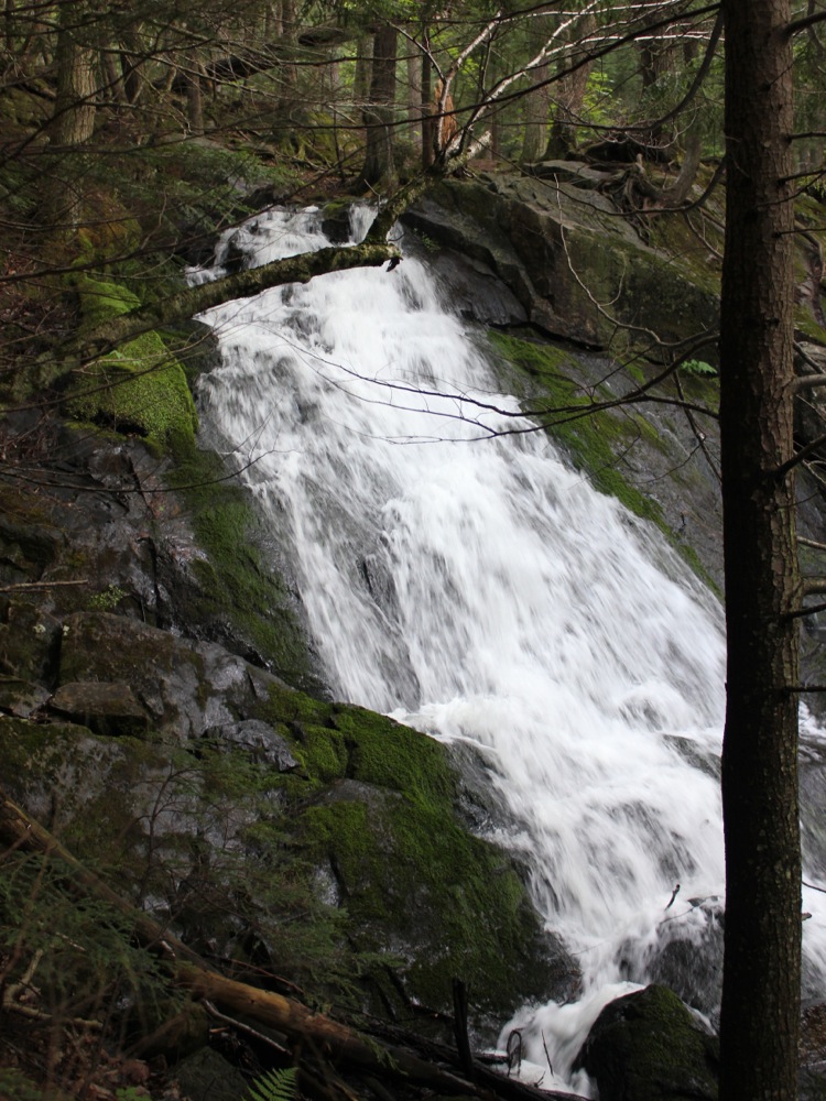
Upstream of the main falls are three more drops each around 5 feet high. The first of these is a short distance above the main falls and easy to reach from the north side of the creek. Upstream of that the creek has carved its way through an enormous rock, creating a narrow gorge. A second, not easily seen, drop is in the gorge. A third drop is beyond that.
[Lake Superior] [Marquette & Baraga County] Nearby Falls
Marquette County has dozens of waterfalls, many of them are in remote locations in the wild area north and west of the city of Marquette. This site has a rather comprehensive list of the falls. Most of them are better described as rapids as they tend not to be very high or steep. The Yellow Dog River has a number of falls, including Yellow Dog Falls, which is just a few miles to the south, and Pinnacle Falls, which is about 10 miles to the southwest. Both of those distances are as the crow flies. The actual routes are hardly so direct. The Dead River Falls are 20 miles to the southeast.
Photo Gallery
 |
 |
 May 2012 |
 May 2012 |
 The first drop above the main falls |
 The uppermost drop |
This page has been accessed
100305 times.
Last Modified:
Tuesday, 07-Aug-2012 20:40:07 MDT.