


Potato Falls is in Gurney Wisconsin. This is a very impressive waterfall. If you are tired of having your hands held by the State Parks and are looking for a big waterfall that you can freely climb all over, risking life and limb, this is the one for you.
The waterfall is located in a county park in Gurney. The park is easy to find, and there is no fee. Gurney is on Hwy 169, about 12 miles northeast of Copper Falls State Park and about 3 miles south of US 2. The park is at the end of Potato River Falls Road, west of Hwy 169. Potato River Falls Road is gravel, but it is in good shape and the park is just about a mile from Hwy 169.
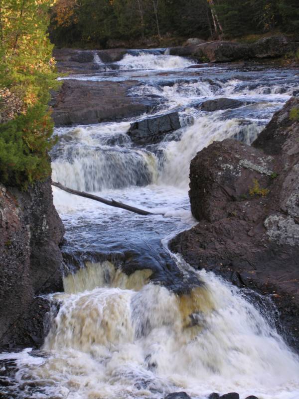
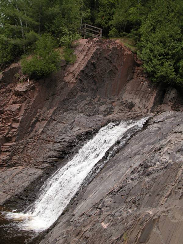
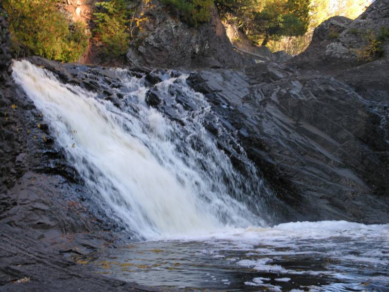
The park consists of a parking lot, a picnic area, a pit toilet and some trails to view the falls. To view the upper falls take the trail to the left. There is a sign indicating it is the trail to the upper falls. The trail ends at an observation deck from which you can view the upper part of the waterfall. This is a complicated waterfall consisting of several drops each going in different directions and I do not think there is any vantage point from which you can really see all of it. Below the part visible from the observation deck, the water tumbles down another 20 feet in two different places. In high water it probably becomes one big sheet of water.
From the observation deck it is fairly easy to get down to the river. From here you can walk downstream to the top of the Lower Falls, or clamber around on the rocks and through the water looking for better views of the upper falls. In higher water this may be dangerous if not impossible. If you could get to high ground on the far bank you might be able to get a more comprehensive view of the entire falls.
Nearby Falls
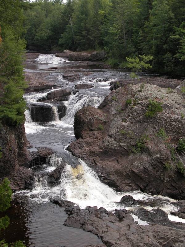
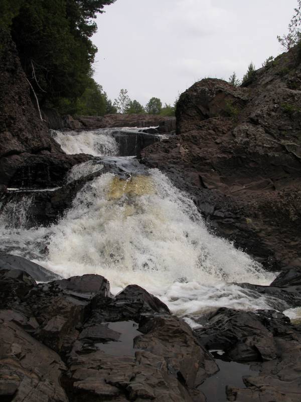
There are a lot of waterfalls in this area. The Lower Falls are a short walk away. Note, the Upper Falls are not visible in the picture above. Copper Falls and Brownstone Falls are 12 miles away to the southwest. Just follow Hwy 169. Superior Falls is about 15 miles away to the northeast.
Photo Gallery
 July 2004 |
 July 2004 |
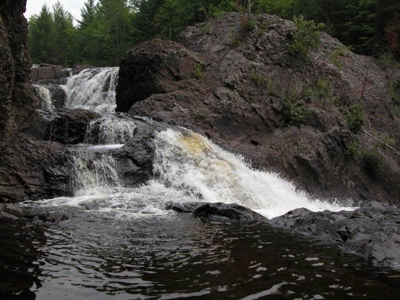
 One of the lower drops. The top of the other is visible in the above right picture. |
 |
 |
 October 2006 |
This page has been accessed
65891 times.
Last Modified:
Friday, 23-Oct-2009 19:37:48 MDT.