


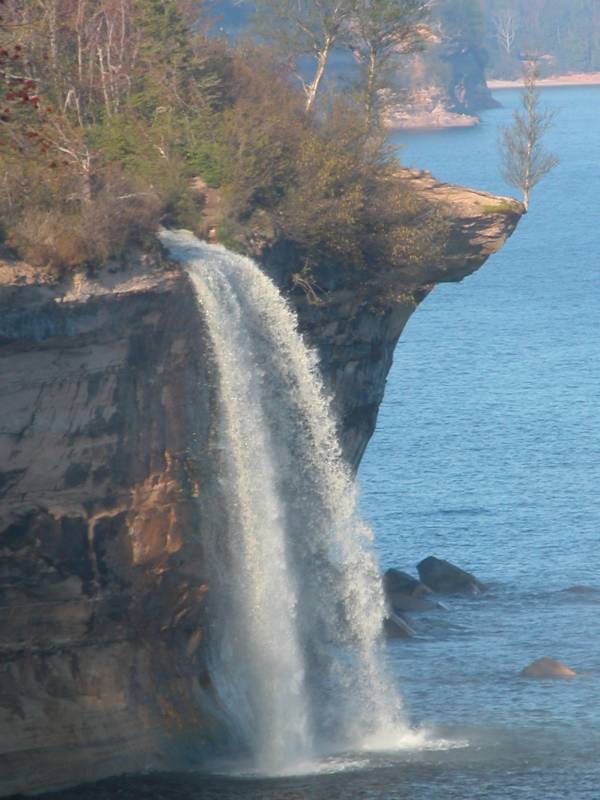
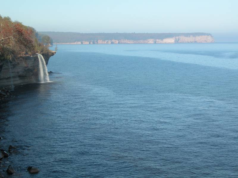
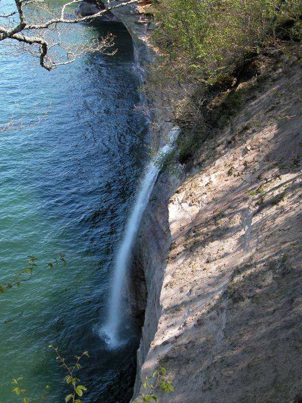
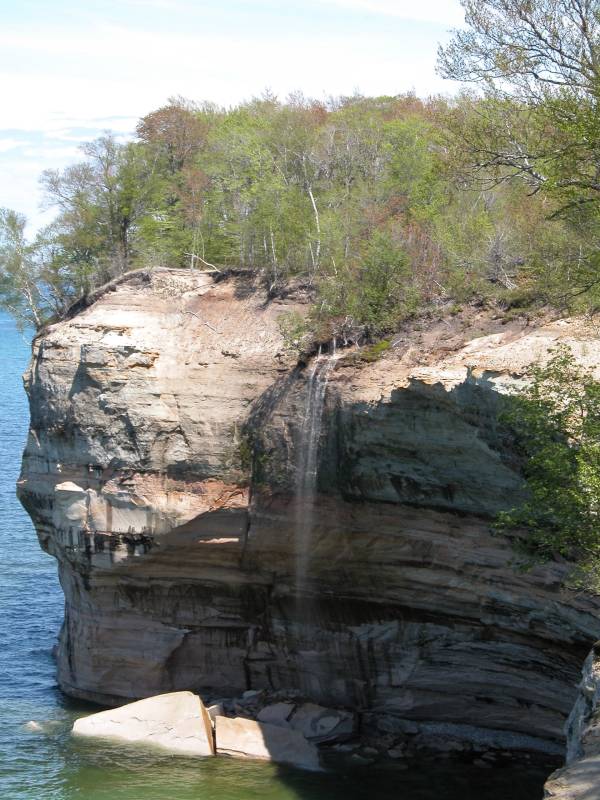
Spray Falls is the remotest, and perhaps the most impressive of the several waterfalls in Pictured Rocks National Lakeshore. The 70' waterfall plunges over the cliffs at Pictured Rocks and lands directly in Lake Superior.
The falls is right on the edge of the cliffs, and the creek has not cut back into the cliffs at all, so it is impossible to view the falls from the front unless you are on the water. The cliffs are sheer for miles in both directions, so there is no way to get near the base of the falls without a watercraft. Lake Superior is too cold for swimming. :)
The Lakeshore Trail passes right over the top of the falls, and you can get right to the brink of the falls. Be careful because the cliffs are undercut and unsafe in many places. About 1/4 mile east of the falls there is a safe lookout point from which you can get a nice, but distant, side view of the falls. There is a sign marking the lookout.
The shortest hike to the falls is from the Little Beaver Lake campground. This is about a 2.5 mile hike one way along the cliffs. It is about a 2 mile hike one way from Chapel Beach, but reaching Chapel Beach requires a hike of at least 3 miles. A very popular and impressive hike at Pictured Rocks is the Chapel loop. If you add the side trip to Spray Falls, you can see three of the park's waterfalls on this hike. Starting at the Chapel parking area, hike to Mosquito Beach, passing Mosquito Falls on the way. Then head east along the cliffs, passing the impressive Indian Head and Grand Portal Point, to Chapel Beach. Continue east to see Spray Falls, and some seasonal falls, then double back to Chapel Beach. Finally, hike back to the parking area, passing Chapel Falls. The whole hike is about 13 miles, and can be done in a day. You can also make a two day adventure of it, camping at Chapel Beach.
In wetter weather, Spray Falls has a smaller companion falls to the east. There are two other seasonal falls between between Spray Falls and Chapel Beach.
[Lake Superior] [Alger County] [5 Mile Map] Nearby Falls
Chapel Falls is about a 4 mile hike from Spray Falls. Mosquito Falls is a 5 to 6 mile hike. Back in town you can find Munising Falls and several others. Sable Falls is some 20 miles to the east on foot, but it is 30 miles by truck on some very rough roads. If you want to stick to paved roads it is an 80 mile drive.
Other Websites
Michigan Interactive has some nice pictures of the falls from the water.
Photo Gallery
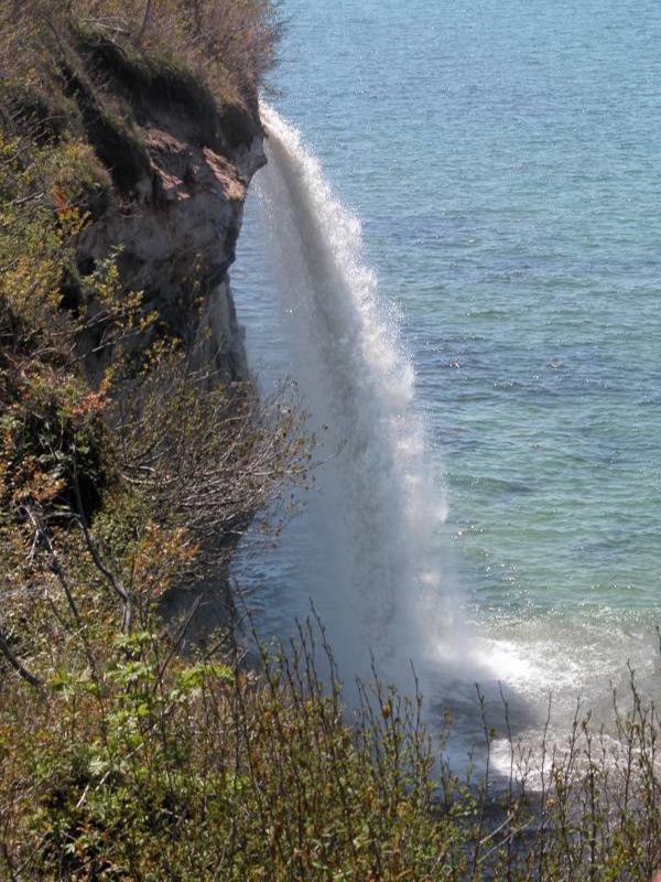 |
 The Brink. The viewing area is visible in background. |
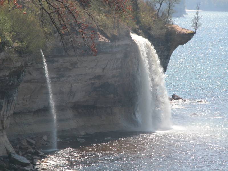 Seasonal Companion |
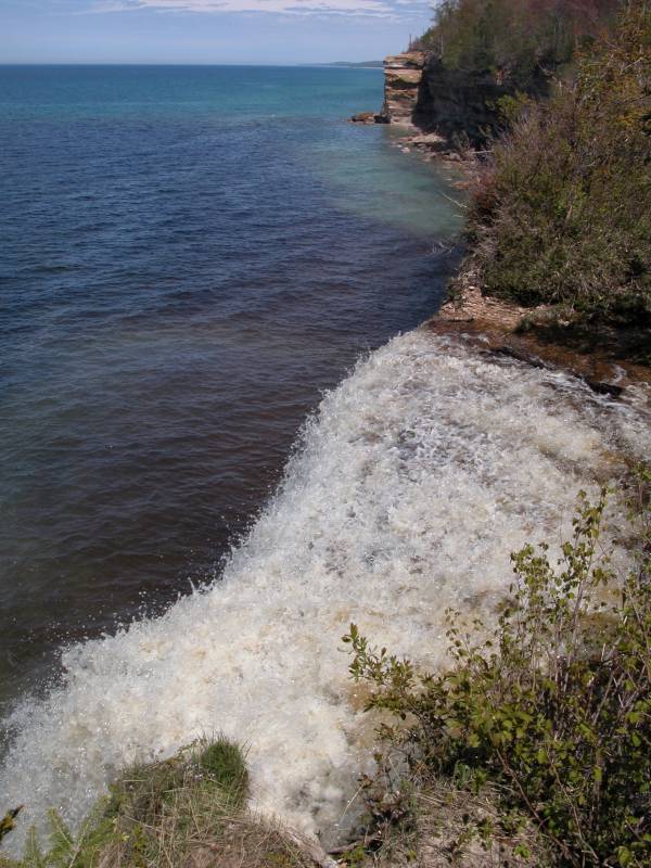
 A Big Plunge Pool. :) |
 Seasonal Falls |
 Seasonal Falls |
This page has been accessed
105977 times.
Last Modified:
Sunday, 27-Sep-2009 21:01:02 MDT.