


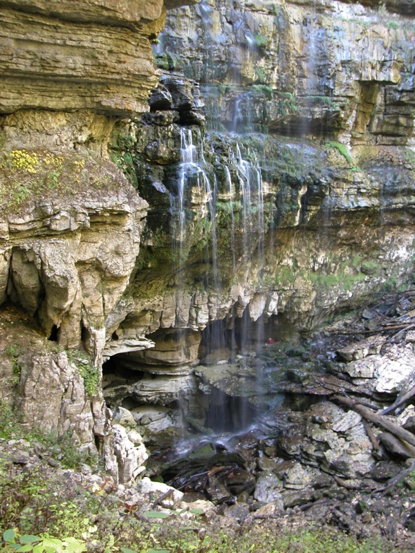
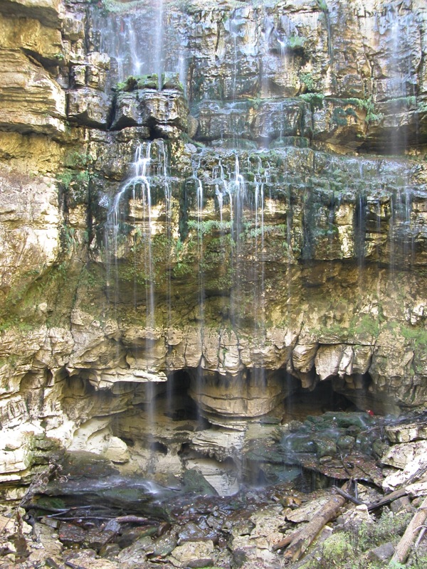
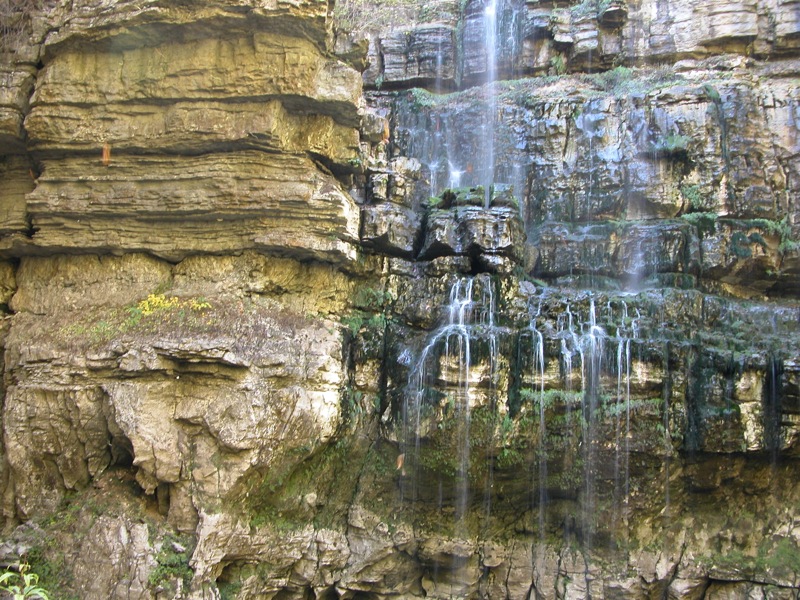
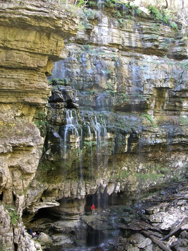
Deep in a wilderness area south east of Sparta Tennessee an unnamed creek flows out of a cave, and then promptly falls over a 120 foot cliff into another cave, forming Virgin Falls. The creek is exposed to the sky for only about 60 feet. Where it comes from, and where it goes are known only to spelunkers. There are a couple other falls that flow into or out of caves in this part of Tennessee, but I believe Virgin Falls is the highest and that the creek spends the least amount of time above ground.
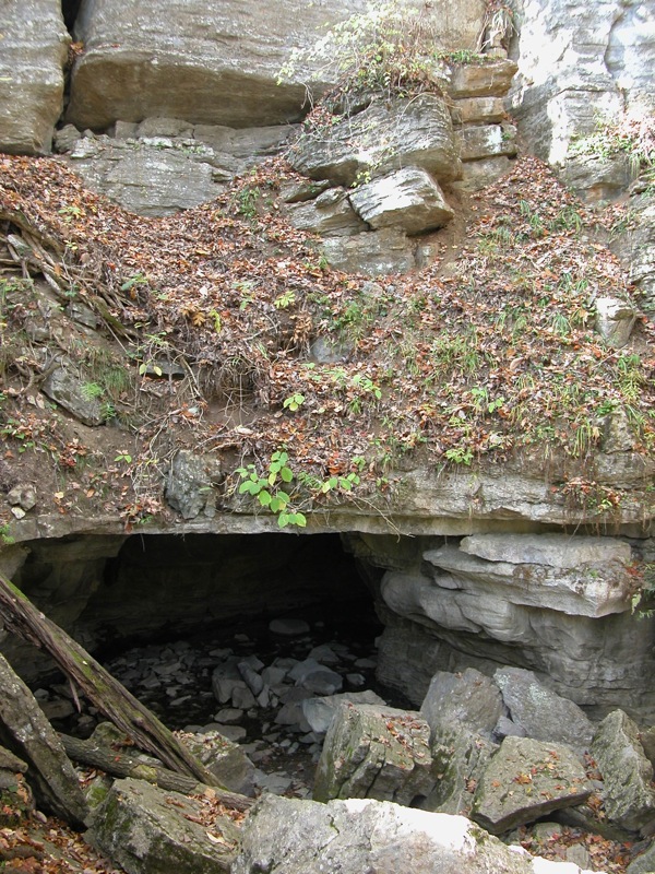
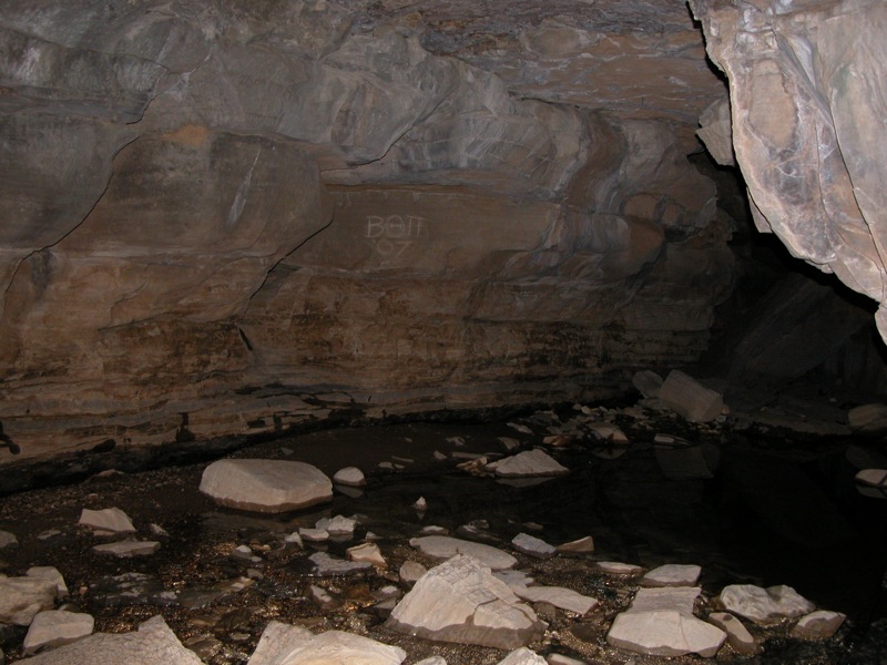
It is a 4 mile hike to the falls. The trail is well marked, but it is rugged. The hike back is especially rugged as it is mostly uphill. Along the way you will pass two smaller waterfalls. A fourth waterfall is located on the loop near Virgin Falls. A trail leads to the top of the falls and to the cave out of which the cave flows. Depending on water levels and how bold you are, you can easily enter this cave. As can be seen in the pictures below, you can also enter the caves at the base of the falls. This may only be possible when the water levels are low.
I had the misfortune to visit the falls during an extended drought. In normal conditions there is much more water flowing over the falls. The only plus side to the lower water levels is that you can see the interesting rock formations around the caves at the bottom of the falls.
Virgin Falls is located south of Highway 70 between Sparta and Crossville. From Highway 70, turn south onto Eastland road in the community of DeRossett. Follow Eastland road for 6 miles and turn right onto Scott's Gulf Road. Continue for two miles. The parking area and trailhead will be on your right. The trail head for Polly Branch falls is on the left just before the Virgin Falls trailhead parking area.
Other Websites
Many excellent photos of Virgin Falls with considerably more water can be found online. Virgin Falls faces north, so overcast days may be the best time for photographs.
Nearby Falls
The trail to Virgin Falls passes Big Branch Falls, and Big Laurel Falls. Big Branch Falls is only about 10 feet high and was bone dry when I visited. Big Laurel Falls is about 30 feet high, and flows into a recess cave. Unfortunately it was just a trickle because of the drought. Sheep Cave Falls is located near Virgin Falls. The wet weather Wildcat falls is located on the south side of US-70 between Sparta and Virgin Falls. The trailhead for Polly Branch Falls is just up the road. There are dozens of other waterfalls within 50 miles.
Photo Gallery
 |
 |
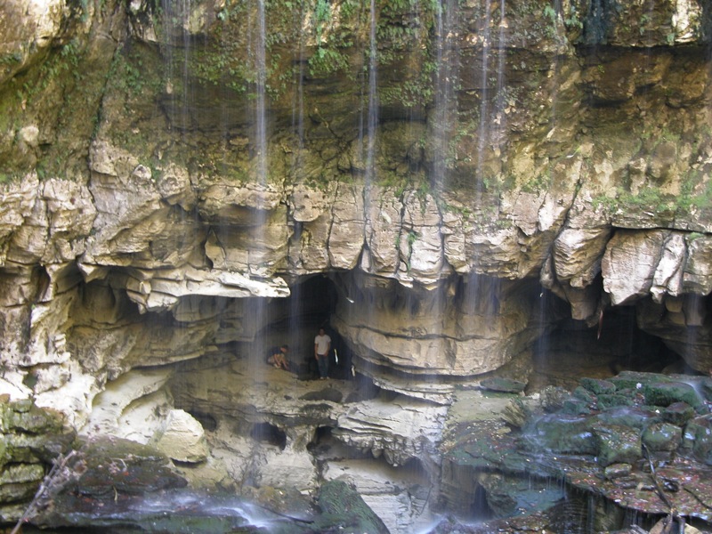 People in caves |
 More people in the caves |
 The 'source' of Virgin Falls |
 Inside the cave |
 Looking from the source to the drop |
|
This page has been accessed
83861 times.
Last Modified:
Thursday, 22-Oct-2009 21:15:15 MDT.