


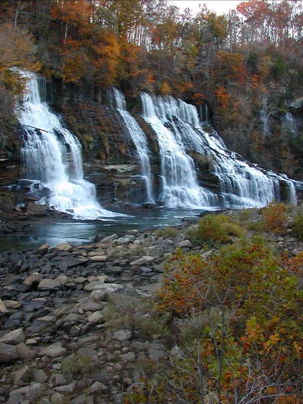
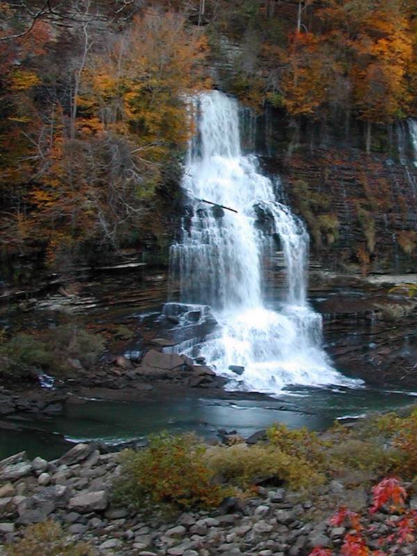
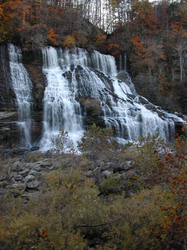
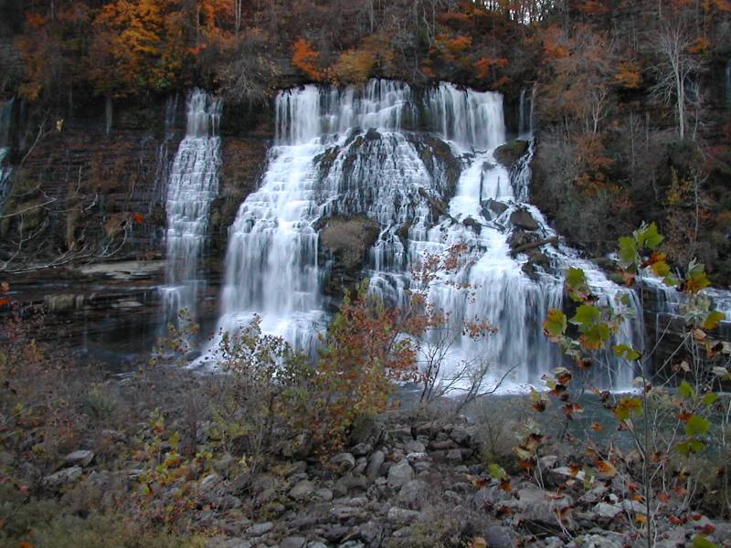
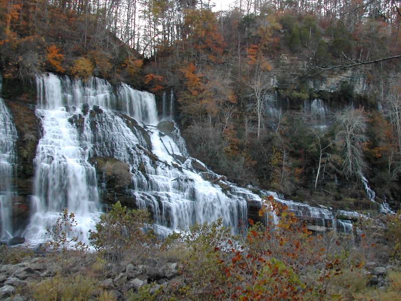
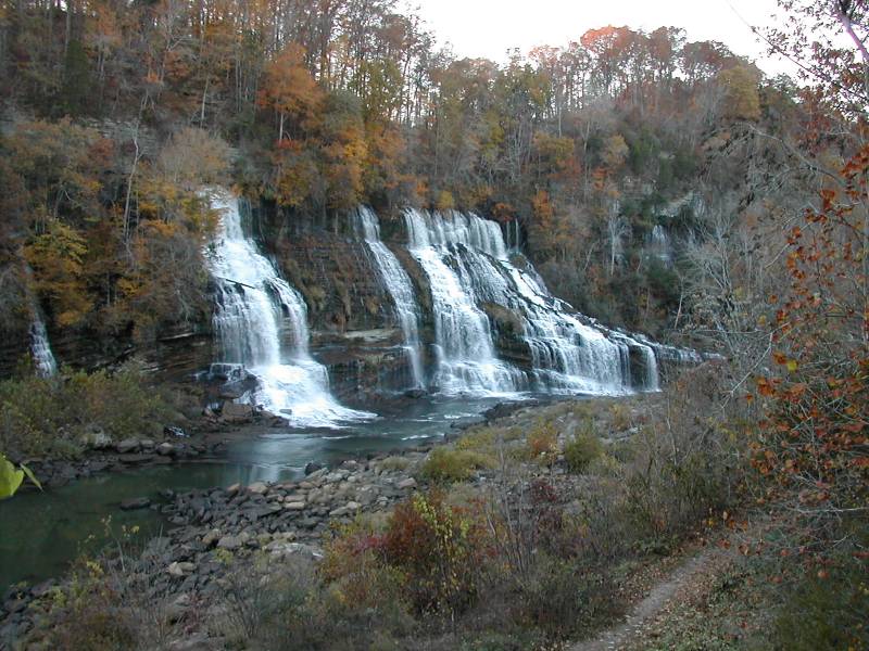
Twin Falls is not a natural waterfall. It is a byproduct of the damming of the Caney Fork River and the power house. The dam backed up the Caney Fork and Collins River. The Collins flows into the Caney Fork about a mile upstream of Twin Falls, but at this point the two rivers are only 1000 feet apart. Water is diverted from the Collins to feed the power house along man made channels, but the water also found its own paths through the limestone to feed Twin Falls. The water pours out of the gorge walls about 80 feet above the Caney Fork River, and about 40 feet below the top of the gorge.
The dam was built in 1925, but I do not know how long it took for the falls to form, or what people thought of it at the time. I imagine it must have been a bit of a surprise.
There are two main streams pouring out of the gorge wall, which apparently is the reason the falls is named "Twin Falls". There are several other smaller streams seeping out of the wall, as can be seen in the pictures. Between Great Falls and Twin Falls there is a lot of seepage.
The falls are located in Rock Island State Park, just downstream of the Great Falls Dam. The falls can be best seen from north/east side of the gorge. Route 287 runs through the park, but it is on the wrong side of the gorge. There is a one lane bridge on the dam that will take you to the the viewing area for the falls. Signs will tell you which way to go. If you do not want to deal with a one lane bridge, follow 287 east to 136 and head north. Take the first left after the bridge. According to Google Maps this is Power House Road, but I do not know if it is signed.
There is a parking area across from the falls, and stairs take you down to the level of the Caney Fork. On the other side of the river there is a parking area for the Great Falls overlook. You can get a distant, obstructed view of the falls from here. At first glance it looks like you can walk up to the falls along the bed of the Caney Fork, but outflow from the power house will block you before you get there. The entire area around Twin Falls is subject to sudden rises in water level if they decide to open the dam.
[Cumberland Plateau] Nearby Falls
There are lots of waterfalls in this part of Tennessee. The mostly dry Great Falls is just upstream. Burgess Falls Fancher Falls, Evins Mill Falls, and Cul-Car-Mac Falls are all to the north around Center Hill Lake. Cane Creek Falls, and Fall Creek Falls are 40 minutes away to the south.
Photo Gallery
 Twin 1 |
 Twin 2 |
 |
 |
 |
 |
This page has been accessed
127777 times.
Last Modified:
Monday, 03-Jul-2017 23:34:58 MDT.