


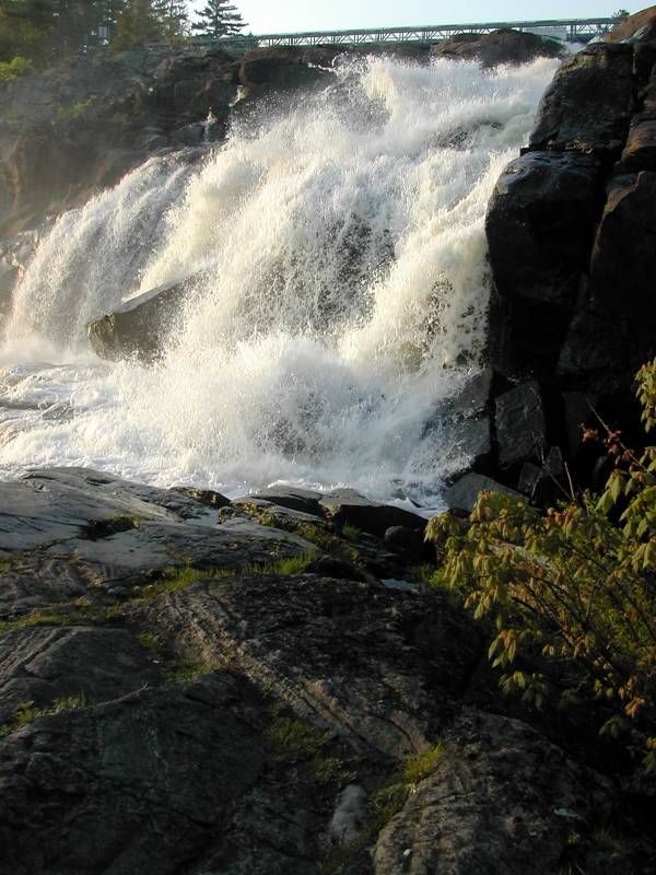
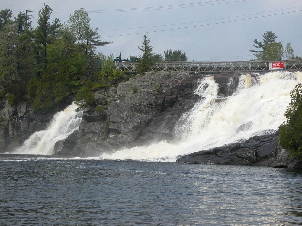
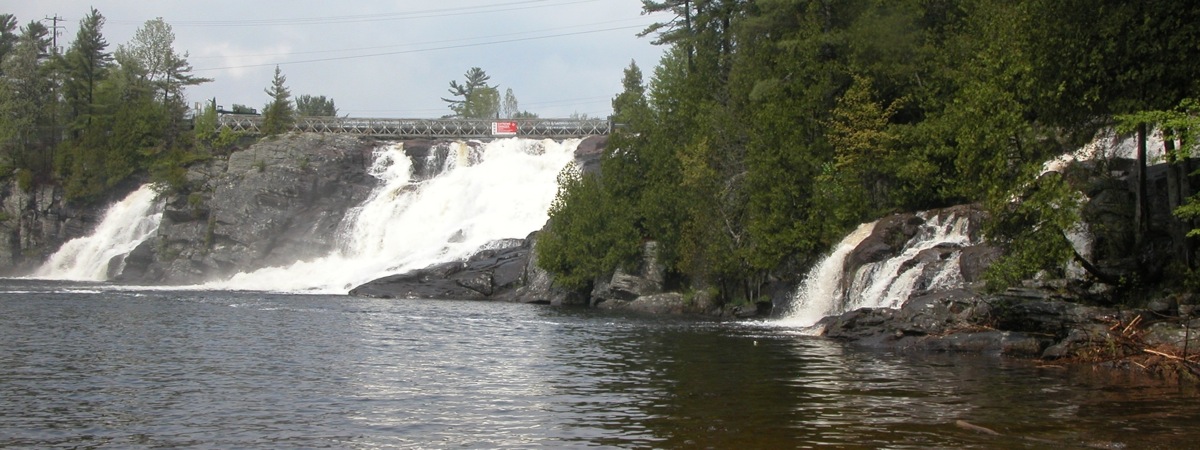
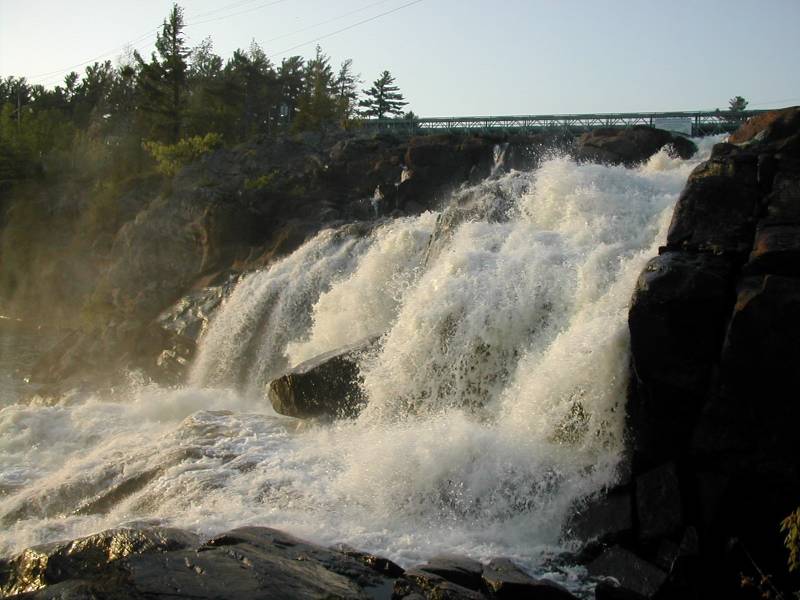
Muskoka High Falls is located on the north branch of the Muskoka River 6 km north of Bracebridge. This is one of the most impressive waterfalls in the area. The river falls about 50 feet in a single drop. It is not a plunge, but it is much steeper than most of the cascades found in this region. The falls is divided into two segments. The river would have to be awfully high for the segments to combine.
There is a power station above the falls, and water is diverted from the river, but the falls are still an impressive site. There was talk of expanding the power station at the expense of the falls. I do not know what the final decision was, but in 2011 the falls were still flowing vigorously.
There is a roadside park next to the falls. The views from land are somewhat limited. The river is very wide and deep below the falls, so you cannot stand directly in front of the falls. The park does include a part of the opposite shore from where you can get a not quite head on shot of the falls. There is a private water park and cottages directly opposite from which you can get better views of the falls. You can even rent a paddle boat.
High Falls Park is located right by the Hwy 11 and Hwy 117 Junction. It is not well signed, and it is easy to miss. From the Junction head west on Hwy 117/Cedar Lane. The first right takes you to the falls. From downtown Bracebridge, take Taylor street west, and then Cedar Lane north to reach the falls.
From the park you can get some easy side views of the falls. To get a better view you have to climb down on the rocks a bit. To reach the opposite shore, follow the trail into the woods and cross the bridge over Potts Falls. When the trail branches, take the right branch down to the river. It is an easy trail except for the last 10 feet or so when it drops down to the shore. From here you can see High Falls and the Little High Falls at the same time.
You can also reach the falls from High Falls road, but surprisingly it is not as easy or optimal. There is a dirt access road for the dam just before High Falls road runs into Hwy 11, and a small parking area on the north side of the river. You cannot see the falls from here, but you can walk across the dam to the picnic area.
"High Falls" is known as "The Niagara of the North". Kakabeka Falls also claims this title, and being farther north and larger, has a better claim. The falls with the best claim to being the "Niagara of the North" are the waterfalls in Northwest Territories such as Virginia Falls and Alexandra Falls.
[Lake Huron] Nearby Falls
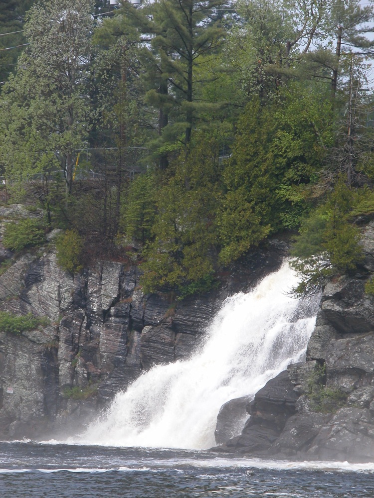
The Muskoka region is full of waterfalls, although many of them have been all but obliterated by dams. Bracebridge claims 22 falls, but that is a generous count in my opinion. The much smaller Pott's Falls and Little High Falls are located just a few hundred meters from High Falls. There is supposedly falls named "Muskoka Canyon Falls" nearby as well, but I have not been able to find any photos or information about it. A few kilometers downstream of High Falls you can find Wilson Falls, and Bracebridge Falls. Muskoka Falls can be found on the south branch of the Muskoka River just south of Bracebridge. Ragged Falls is about 50km away as the crow flies. Rosseau Falls is about 40km to the east.
Photo Gallery
 View from shore, May 2011 |
 |
 The far channel, May 2011 |
 High Falls and Little High Falls |
 |
|
 May 2007 |
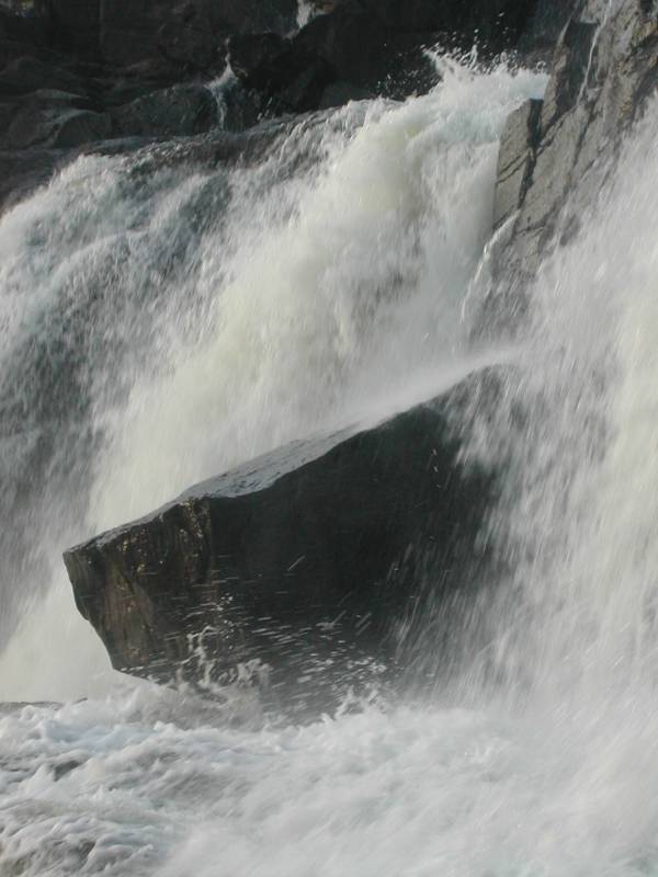 May 2007 |
 May 2007 |
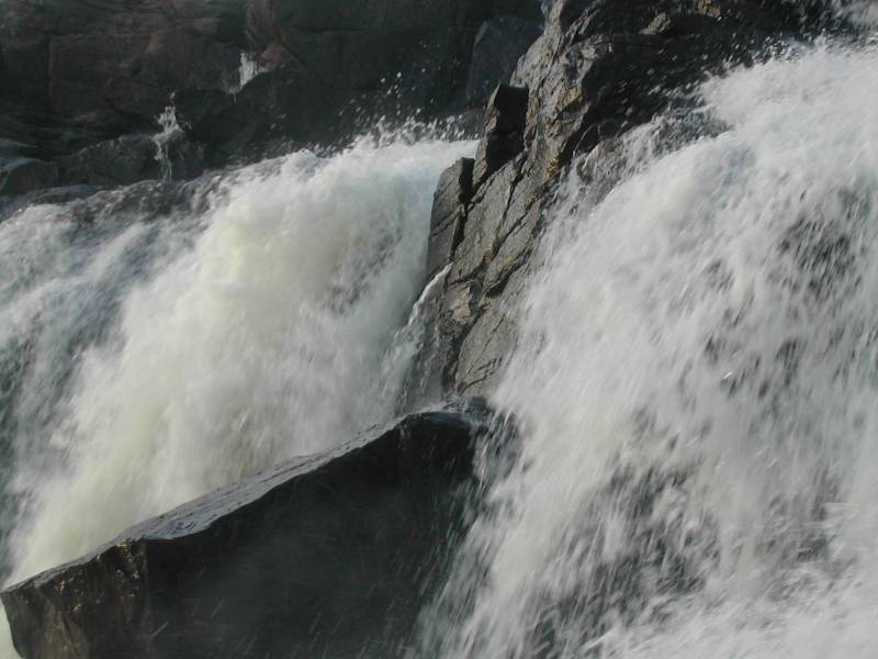 May 2007 |
This page has been accessed
74355 times.
Last Modified:
Monday, 20-Jun-2011 22:05:26 MDT.