


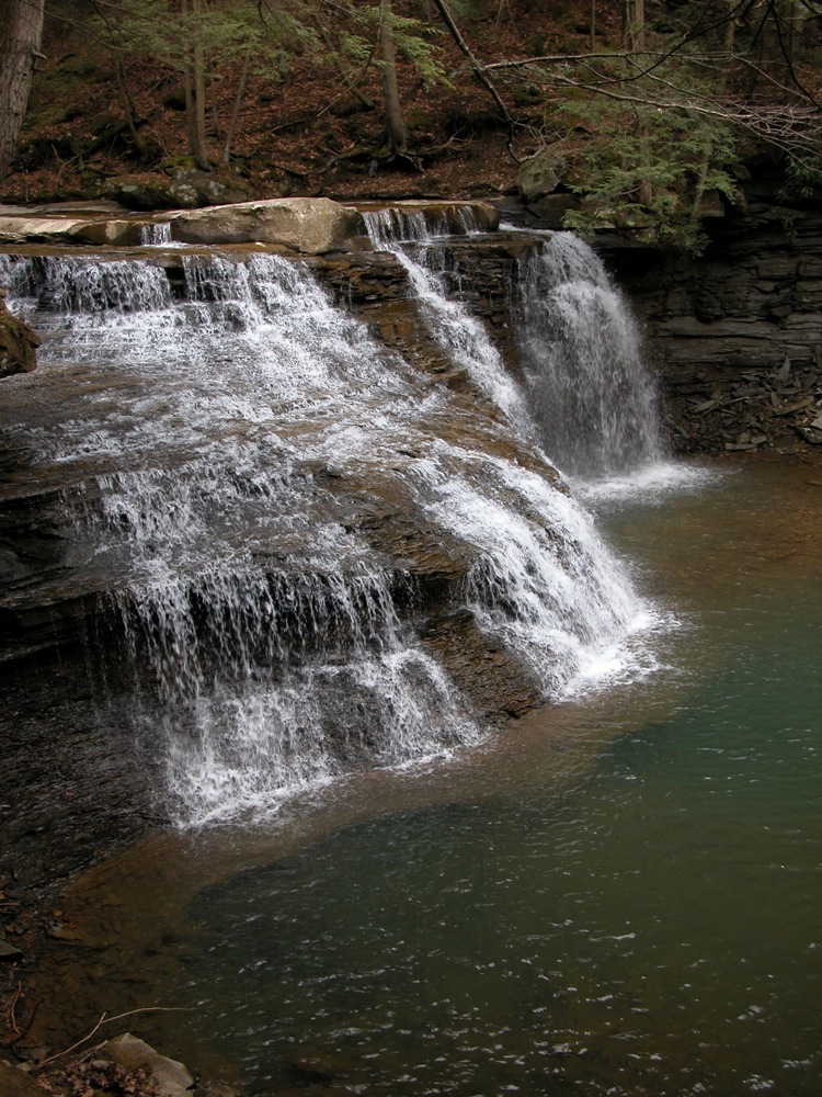
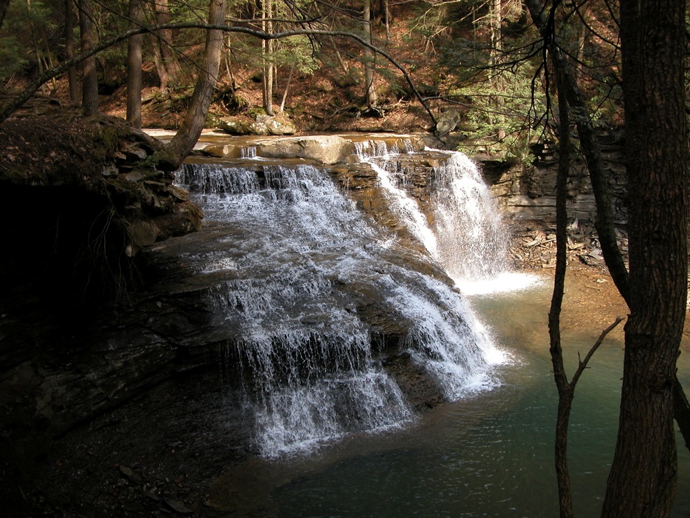
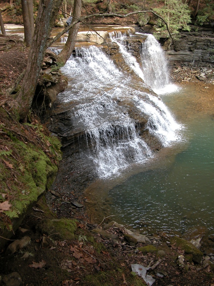
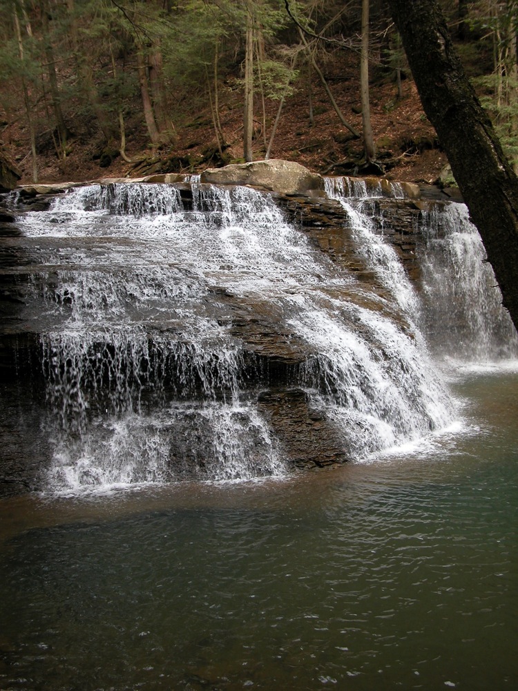
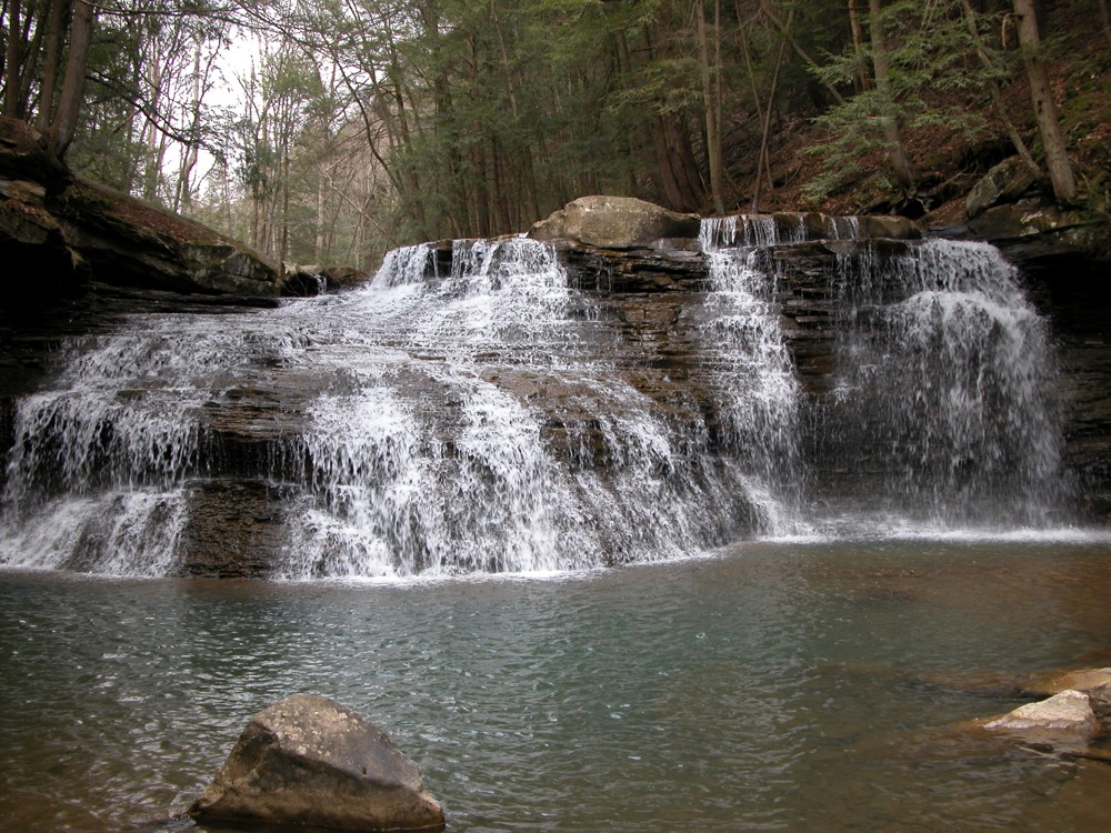
Freedom Falls is one of the larger and wilder falls in this part of the country. It is over 20' high and 50' wide. It is located in some state owned game lands on Shull Run, about a 1/2 mile upstream of its confluence with the Allegheny River. There are no fences or signs here, and you can easily walk up to the brink or base of the falls.
In addition to the falls, this spot features two other attractions. The first is an old very well preserved stone furnace. This is located just a few hundred feet downstream of the falls. Further downstream you will find the Allegheny River Trail and the mile long Rockland Tunnel it passes through. The Rockland Tunnel is open to non-motorized travel only. The tunnel leaks a bit at the eastern end, and in March there was a lot of ice on the path.
Reaching this falls is a bit of a challenge. There may be easier ways to get there, but here is roughly how I did it. From the town of Emlenton, head east on Route 38/208. Take a left on Sloan/Panther Spring Road. The road changes name, and I am not sure how it is signed at this point. This is a dirt road, and quite bumpy in some spots. Continue straight on this road. You will cross Whitehall and Airport roads, both of which are paved. The road continues into a wilderness area, and is called Dotterer for awhile. You will pass some old bridges, and climb up a switchback. You eventually reached a paved road again outside the town of Pittsville. Here you take a left on Rockland Station Road, and continue for about a mile. There is a small parking area on the left side of the road near the falls. From there it is a short walk to the falls.
The road continues down to the Allegheny River, but ends there, so you have to go back out the way you came in. Be careful using online maps for this area. Some of the roads they show are not open to motorized traffic.
As mentioned, the falls is not very far from the Allegheny River trail. You could bike to the falls starting at Emlenton. It is about an 8 mile bike ride, 1 mile of which is the Rockland Tunnel.
Despite its remoteness, this is a fairly popular waterfall. At least a half dozen groups were there on a Sunday in March.
Nearby Falls
The similar, but smaller and much easier to visit Springfield Falls is about 40 miles away.
Photo Gallery
 |
 |
 |
 |
 |
 |
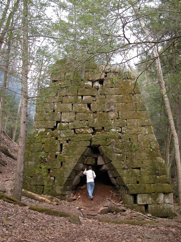 The furnace. |
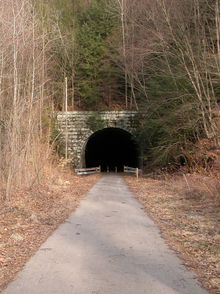 The Rockland Tunnel. |
This page has been accessed
116098 times.
Last Modified:
Monday, 04-Jul-2016 06:39:01 MDT.