


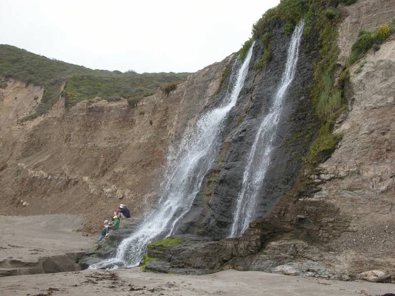
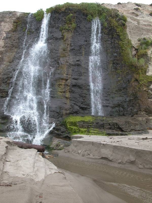
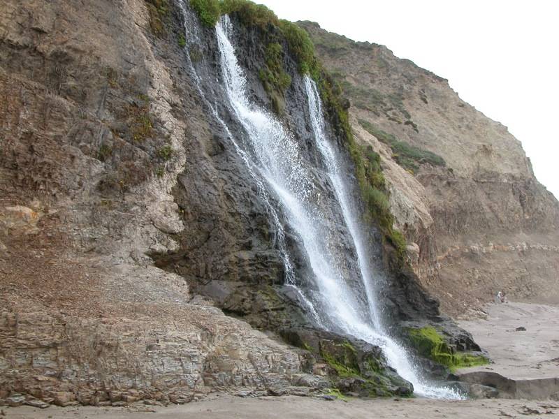
Alamere Falls, located in Point Reyes National Seashore, flows over a 40 foot cliff and into the Pacific Ocean. Nearly all falls eventually flow to the sea (except some located in basins), but it is rarely so direct. It is interesting to see waves reaching up to the base of a waterfall. Above the main falls are two smaller drops, each about 10 feet high.
There a number of trails in Point Reyes and many ways to reach the falls, but the most direct route starts at the Palomarin trailhead located at the south end of the park. This can be reached from Highway 1 by taking Olema-Bolinas road and following the signs to the bird observatory. This is a popular trailhead and by mid afternoon the parking lot was overflowing.
For the most part the trail to the falls is fairly wide and level, but this is a hilly landscape so there are some ups and downs. The trail hugs the seashore cliffs much of the way, offering many spectacular views. The final 1/2 mile to the falls is a bit more adventurous. There is a sign on the main trail marking the unmaintained Alamere Falls trail. This is a narrow foot path which passes through some very dense, head high vegetation, followed by a steep descent down to the upper falls along what appears to be a runoff channel.
You can view the main falls from the cliffs, but to get a really good look at them you need to get down to the beach. There is another steep "trail", that looks like another runoff channel, that you can climb down to the beach. The cliffs are very brittle, so there is a lot of loose rock and the footing can be uncertain.
This part of the world does not get a lot of rain outside of the winter months. The falls were still flowing in early June when I visited, but they were getting thin.
The San Andreas Fault runs through Point Reyes. Alamere Falls is slowing heading north with the rest of the Pacific plate.
Other Websites
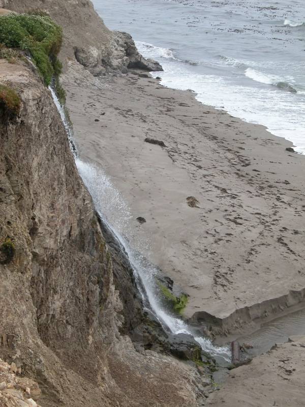
It was foggy and grey when I visited the falls, which is a pretty common occurrence. For some excellent pictures of Alamere Falls with better lighting, see Alamere Falls from waterfallswest.com. It is interesting to note that the beach at the base of the falls in those pictures is much rockier. When I visited the falls the sand was piled right up to base of the falls, and the creek had cut a two foot deep channel into the sand below the falls.
Nearby Falls
The Pacific coast is well outside of my normal stomping grounds. For a much more comprehensive list and description of the falls in the area see waterfallswest.com. If you walk along the beach you can find two other wet weather falls tumbling off the cliffs. Morse Gulch Falls is just off of Highway 1 south of Point Reyes, but the creek was bone dry in June, and the trail exteremly overgrown and faint.
Photo Gallery
 |
 |
 |
 |
 |
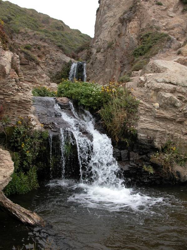 The Upper Drops |
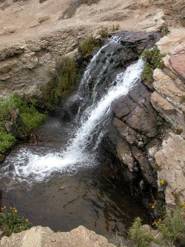 The Third Drop |
 The Uppermost Drop |
This page has been accessed
67256 times.
Last Modified:
Monday, 08-Dec-2014 20:15:06 MST.